Lake Mývatn and Powerful Dettifoss Day Tour from Akureyri
Max 12Pickup1.5 hours at the falls
From $401 per person
Two roads reach Dettifoss and they are not two ways of doing the same thing. Every Dettifoss tour from Akureyri uses one of them. They arrive on opposite banks of a canyon you cannot cross at the falls, they are surfaced differently, and they are open at different times of year. Which one you take is the single most consequential decision of the visit, and most guides never mention it.
| Route 862 — west bank | Route 864 — east bank | |
|---|---|---|
| Surface | Paved | Gravel, slow going |
| Season | All year, but not in winter service January to early April | Closed from the first autumn snow to roughly the end of May |
| Vehicle | Any car in summer | Higher clearance is the sensible choice |
| Car park | The larger of the two, with toilets | Smaller, no facilities |
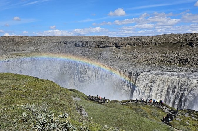
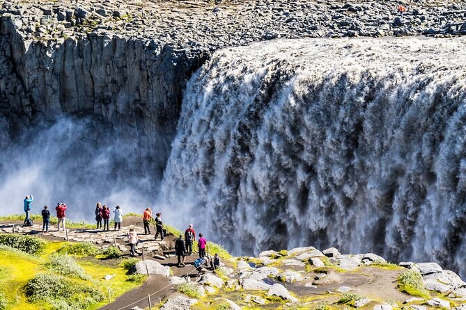
| The view | Across and down onto the falls from above | Head-on, at the level of the lip |
| Walk on to | Selfoss, 0.6 km further | The Hafragilsfoss rim viewpoint |
| Guided tours | Every departure listed uses this side | None of them |
Route 862 leaves the Ring Road on the Mývatn heath and runs north to the west-side car park. It is the newer of the two by a long way: 55 kilometres of paved road opened in stages between 2010 and 2021, and it is what turned Dettifoss from a rough-track destination into somewhere a hire car reaches in an afternoon. From Akureyri the whole drive is about two hours.
The car park is the larger of the two and has toilets, which is the only facility on either side. From it the walk to the viewpoint is about a kilometre; the national park lists the return trip as 1.5 kilometres and half an hour to an hour. The signpost at the junction reads Dettifoss 0.2 kilometres one way and Selfoss 0.6 the other, and it names the marked routes D1, D2 and D3.
Route 864 approaches from the north off Route 85 and is unpaved for its whole length. The national park describes it as slow going and closing when the autumn snow falls, reopening in spring only once the wet mud has dried — which means the opening date moves every year and is usually somewhere around the end of May.
What you get for the drive is the view from directly in front of the falls, at the height of the lip, which is the angle most of the famous photographs are taken from. You also get the rim viewpoint over Hafragilsfoss, 27 metres and about two kilometres downstream, which almost nobody sees. What you do not get is toilets, a paved surface, or any chance of arriving between October and May.
The decision is made for you: every guided departure listed here uses the paved road, because a coach or a minibus on a shifting gravel track is not a sensible proposition and the season is too short. If you are booking a seat, you are going west.
Paved, faster, toilets, and the Selfoss path. In a hire car with standard insurance this is also the road your rental agreement is happiest about.
The head-on view is genuinely different from the view from above, and Hafragilsfoss is a real bonus. Budget the extra driving time and check the road is open before you commit to it.
Yes, and it costs you roughly two and a half hours of driving to do it. There is no bridge at the falls: the two rims are joined only by going all the way round, north to Route 85 and back down, or south to the Ring Road and back up. If you are already spending two hours getting there from Akureyri, adding the crossing turns a comfortable day into a long one. Most people who do it are staying at Mývatn or Ásbyrgi rather than driving from town.
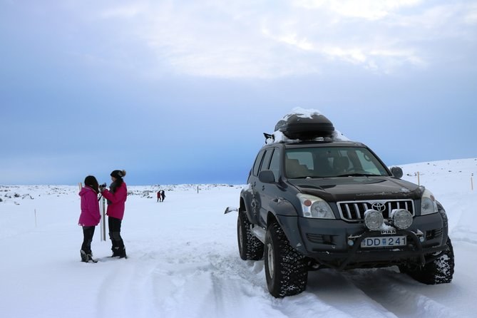
Between January and the beginning of April, Route 862 is not in winter service. That is not the same as closed. The road is paved and unbarriered; it simply is not routinely ploughed or monitored in those months, and it opens and shuts with the weather. Travellers reach the falls in February and March most years, and one of the departures listed here has run in January.
The practical answer is the same either way: check the Icelandic Road and Coastal Administration on the morning you travel, not the night before, because the answer changes overnight. The national park points visitors to exactly that source.
It makes the call for you at seven in the morning, and refunds you if the answer is no. Every day tour from Akureyri here cancels with a full refund when the weather closes the road, and several state outright that they will offer another date instead. That is worth more in November than it is in July, which is the honest way to decide between driving and booking — and the month-by-month page sets out which months are which.
For where everything sits relative to everything else, see the Dettifoss map. For the practical detail of the visit itself, visiting Dettifoss. To compare the departures, Dettifoss Tours.
From $401 per person
From $306 per person